
 |
NEW European Waterways Map and Directory Euromapping, 2009 The 3rd edition of our popular map and directory was published in late November 2008. This new edition, with its 64-page directory by David Edwards-May, has received contributions and new material from throughout Europe, and will provide a mass of information of value to all those who are interested in inland navigation, as a mode of transport, but also - for a growing number of enthusiasts - a way of life. The two maps (front and back of the sheet) cover the same area as the previous edition: from Ireland and Portugal to the Caspian Sea and, on the other side, a significantly enhanced map covering the denser part of the network, from Dublin to Bratislava on the Danube. The booklet accompanying the map includes many colour photos and larger-scale maps of particular areas. The new edition is available in English only. A French version is being produced. Dimensions 100 x 68 cm. Scale 1:500 000. |
||
|
|||
 |
North American Inland Waterways Map & Index |
||
|
|||
 |
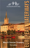
European Waterways Map and concise Directory |
||
|
|||
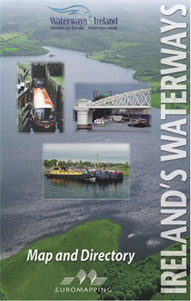 |
Ireland's Waterways Map and Directory by Ruth Delany, edited by David Edwards-May and Michael Grace Third edition of the map of inland waterways which span Ireland from north to south and east to west, together with a concise directory: descriptions of each waterway by Ruth Delany, and information supplied by Waterways Ireland. The full-colour map shows more than 1000 kilometres of navigable canals, rivers, estuaries and lakes, open for cruising holidays in hire boats or private craft. Locks, distances, navigable dimensions and boat harbours, and a useful directory identifying waterway offices, boat hire companies, waterway guides and tourist organisations. Numerous enlargements. Dimensions 100 x 68 cm. Scale 1:500 000. |
||
|
|||
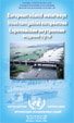 |
UN-ECE
Map of European Waterways
UN-CEE, October 2006 This map will interest all those who are involved in or monitoring inland water transport. Produced by Euromapping for the UNECE's working group on transport by inland waterway in Geneva, it distinguishes waterways by tonnage capacity, from European Class I to Class VII. Folded, 1007 x 682 mm, scale 1:4750000. Two other maps on the reverse, at a distorted scale of approx 1:6000000, show the waterways classified by available draught and by navigability zones (determined by wave height). |
||
|
|||
 |
From
Sea to Sea L.T.C. Rolt, Euromapping, 1994 (additional chapter by David Edwards-May) Remarkably researched and documented history of conception, building and operation of the Canal du Midi, This canal, built in just 15 years (1666-1681), provides a navigable route through Southern France between the Atlantic and the Mediterranean. Tom Rolt, a founder of the movement for preservation of Britain's canals, tells us how this engineering achievement was inspired and led by Pierre Paul Riquet, how he won the support of Louis XIV, and how he overcame formidable technical, economic and social problems which threatened to stop the works. This historical guide, first published in 1973, is also the indispensable companion for tourists discovering the canal today. 240 pages. (french edition Le Canal Entre Deux Mers also available). |
||
|
|||
 |
Inland Waterways of France Imray, 2002 This has been the standard reference on the French canals for nearly 50 years. The original author, E.E. Benest, established the familiar presentation in which a description of each waterway was supported by a table of distances. Since the 5th edition in 1983, David Edwards-May has followed the same pattern, while continuously improving the work in presentation and detail. For the 7th edition the text has been completely revised, and is now illustrated with detailed mapping of every waterway and nearly every junction. There are more photographs and a new selection of colour plates by Hal Stufft. This seventh edition is the most up to date source of information on the subject, and will find a home in the library of every waterways enthusiast. |
||
|
|||
 |
World Canals |
||
|
