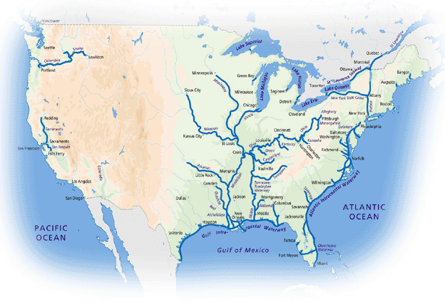
From this overall
map (which is contracted in the "dry" States across the Rocky Mountains),
choose one of three enlargements.
The first highlights the modern waterway network, more than 12 000 miles (19
300 km) of high-capacity waterways maintained and operated by the US Army
Corps of Engineers.
The second
is a larger-scale view of the heritage canals built in the 19th century across
the North Eastern States from Illinois and Indiana through to New Hampshire
and North Carolina.
Finally,
a zoom from the second map encompasses an area at the borderline between these
two networks, geographically, historically and in operational terms. This
is the complex and heterogenous network of canals and canalised rivers which
extends from New York City to Lake Erie, including the Erie Canal (replaced
by the New York State Barge Canal in the early 20th century), the Canadian
heritage canals which have remained in operation for nearly 200 years, and
most of the man-built sections of the St Lawrence Seaway…
Information about the network:
http://www.usace.army.mil/missions/water.html
Information about the America's Great Loop:
http://www.greatloop.com

 |
|